07/11/2008

 
UNDERWATER
ARCHAEOLOGY
Field of underwater archaeology | Rules  |  | Interest of underwater archaeology | Actors | Archaeology in river  | Prospecting | Excavating | Archaeology of wells | Post-excavation
FIELD OF UNDERWATER ARCHAEOLOGY
RULES
Underwater archaeology is the research and the study of the remains in order to know the human activities of last and is implemented in interior waters :
  • artificial often closed: wells, cisterns, underground ducts,
  • natural:  lakes, rivers, ponds, peat bogs, marshes, karst and ground water.
In France, the practice of archaeology or any research being able to lead to archaeological finds is subjected to the law.
It is necessary to obtain the authorizations of the Direction Régionale des Affaires Culturelles and the owner of the ground.
INTEREST OF UNDERWATER ARCHAEOLOGY 
Roman shoe - the Saone river. Ph. L BONNAMOUR. The aquatic environment is very favorable to archaeology :
  • water protects from the destructive human actions,
  • the organic and mineral elements safe from oxygen, the light and the biological activity are preserved often perfectly.
  • There is thus possibility of particular analyses : dating by dendrochronology, paleobotany...

 
ACTORS 

 
DIRECTION REGIONALE DES AFFAIRES CULTURELLES / SERVICE REGIONAL D'ARCHEOLOGIE (SRA) Control research, delivers the authorizations, 
DEPARTMENT DES RECHERCHES ARCHEOLOGIQUES SUBAQUATIQUES ET SOUS MARINES (DRASSM) Government organization in charge of the coordination of research.
PROFESSIONALS (UNIVERSITIES, CNRS...)   In France, the permanent or temporary professional teams are very few.
VOLUNTARIES   Ensure a considerable part of research.
GOVERNMENT, LOCAL COMMUNITIES, BUILDERS, OTHERS Financial support

 
ARCHAEOLOGY IN RIVERS 
Methods of subaqueous archaeology in rivermedium. -BONNIN PH.- 2000Method of archaeological diagnosis subaqueous. -BONNIN PH.- 1999
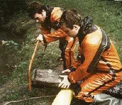
Researches in rivers constitutes the main part of the research. They have a past more recent than those carried out in lakes. Archaeology in rivers has been developed for 20 years, thanks to the penetration of the archaeologist in person in the aqueous element.
The beginnings were primarily the fact of voluntary.
In spite of sometimes difficult conditions of intervention, the results obtained confirmed the possibility of intervention under the water and the formidable archaeological potential of rivers like Saone, Seine, Marne, Charente, Dordogne...
Points of blunders and tools of bargees found in the Seine. Ph. GRAS .
In fresh waters and in particular the rivers, remains of the human activities from prehistory to today are found and relates to many fields.
 
HUMAN ACTIVITIES ARCHAEOLOGICAL REMAINS
Fish and drives out. machines: bow nets, hooks, nets and their weights... 
fixed installations: fisheries, ... 
wrecks floating machines: pirogues, boats, fish ponds.
Habitat piles,  material, dumps.
Crossing fords, vats, bridges.
Worships many documents in particular on the fords.
Transport  wrecks and their cargoes, tackle of navigation: harbour anchors, blunders..., installations, drain.
Energetics grinding of cereals or the tanin, metallurgy, pressing of cloth,  strikes currency, pumping of water, towing, etc.
Floating installations (mills boats) or fixed with wheel fixed or hung to follow the variations of the level of water.
The remains appear in the form of levees and foundations.

 
PROSPECTING

The objective of prospecting is to locate archeological sites.
Preparation
The exploitation of sources of information precedes the interventions on the ground.
  • bibliography
  • history
  • files : old charts, burrows, writings, iconography, administrative documents of the services of navigation...
  • memory of the residents, the dredgers...
The town of Corbeil-Essonnes XVIe century.
Direct prospection by scuba divers
clic !Method:
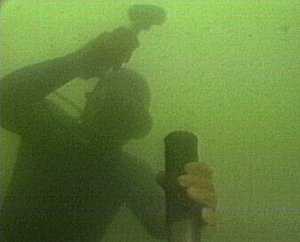
  • Displacement in lace on the river bed in front to the current in order not to being disturbed by the stirred up sediments.
  • Marking out of the archaeological remains by a small buoy released from the bottom.
  • Positioning compared to terrestrial reference marks.
  • Catch of photographic and video view.
Conditions:
  • Depth of a few decimetres to a few meters.
  • Very reduced visibility (zero to a few meters according to the season).
  • Illumination is useless because the suspended particles diffract the light.
  • Commercial sailing and yachting.
Indirect prospection
There are specific means of geophysical prospection bringing into play various parameters : topography, geology, relief... whose interpretation helps with the localization or the comprehension of the immersed sites or to directly locate objects or structures.
 
Acoustic ranging. Ph. GRAS.
  • Bathymetric cartography by acoustic ranging,
  • Electromagnetic prospection with metal detector: the use is strictly regulated by the law,
  • Low frequency acoustic ranging : give a cut of the basement representing the variations in the structure of the bed on several meters of depth.
  • Electric prospection by current (resistivimetry) : visualize the variations of constitution of the geologic bed on several meters of depth.
  • Magnetometric prospection: reveal anomalies of the terrestrial magnetic field due to the presence of objects or archaeological structures : fittings of wrecks, cramps of sealing of blocks, ceramics concentrations.
  • Side scan sonar : produced acoustic images whose solid drop shadows reveal specific anomalies of the relief corresponding to objects exceeding of the bottom.

 
EXCAVATING 
The excavation, as of terrestrial, does not only consist in releasing the remains hidden to recover them.
Acting by removal of material, it causes the destruction of the site, so rigorous principles are applied which will make it possible to preserve all the data contained in the ground.
Work on the Site
  • Clic !geographical delimitation and materialisation of the zone to be excavated,
  • removal of the awkward sediments without damage of the vestiges,
  • excavate archaeological layers by horizontal layers,
  • realization of stratigraphic cuts,
  • observation and topographic positioning of the objects and structures in the three dimensions,
  • deposit and recovery of the vestiges and whole or part of the sediment,
  • recording of the observations.
Water suction dredger in action. Ph. GRAS.
The remains covered with sediment are released with the hand or with particular machines.
  • standard water hose fireman with concentrated or diffuse jet.
  • standard water hose Galeazzi. Aspire the sediments and drives back them backwards.
  • Water suction dredger. Aspiration of the movable sediments and rejection  on the bottom.
  • Air suction dredger. Aspire and goes up the sediments on the surface.
Recording, topography
Measurements,  are taken with the meter and the decametre.
The notes are taken with the pencil on a PVC slate. On certain building sites they are retransmitted on the surface by telephone.
In the case of a squaring, one measures two distances compared to two stakes.
In the case of a reference frame made up of a linear axis, one raises the X-coordinate of the point to be located along the axis and the ordinate compared to the axis (perpendicular distance).
Data recording. Ph. GRAS.
These data are easily transposable then on paper, on reduced scale, using the rule and of the compass or by data processing.
Each statement is put at clean as soon as possible after the diving and a book of excavation is filled to collect the observations not enregistrables by the drawing or photography. Cumbersome objects can be analyzed on the surface, it is in particular the case of certain wrecks.
Taking away
Driving in of a carrot tube. Ph. GRAS.
After space location, the objects are taken and re-installed, in containers closed for most fragile. Particular precautions must be taken for the fragile organic objects which are often in extreme cases of buoyancy. One conditions them  on plates, in closed containers or one takes  them in mound with their boxing sediment.
It is necessary to regularly collect carrots and discs of wood for the dendrochronology.
Particular problems arise for the large-sized fragile objects like the boats. After a precise land prospecting, the composite objects can be dismounted and extracted part by part and the monoxyles objects divided in sections easy to handle which will be reassembled in laboratory later on.
 
For the reinflation without damage, the parts are posed on metal frames after release of the sediments or with a part of the gangue. This requires a preparatory work to insert the supports under the object and the assembly of frame designed especially.
The boat medieval monoxyle assembled of EPERVANS was extracted thus from the Saone in 1991.
It is possible to carry out mouldings with polymerizable elastomers under water.
Medieval boat of Epervans (the Saone).Cl LBonnamour.

 
ARCHAEOLOGY OF WELL 

Under development.


POST EXCAVATION

Work annex to the excavation
It is necessary to envisage on the site an infrastructure - equipment and personnel to ensure the conservation of the fragile objects:
 
hone and ceramic
not very sensitive to drying but to supervise
glass
often oxidized, to keep wet until the final treatment or controlled drying
metal
depending on the state to be dried or preserve in water, to avoid oxidation with the air
wood, textile, fibres, leather
very sensitive to drying. To preserve in the water added with a fungicide safe from the light. For the large objects one can consider a re immersion in an easily accessible place after study

The good conservation of the remains allows analyses
Sampling of a section of stake for dendrochronology. Ph. GRAS.
  • sedimentology on carrots
  • organic macro-remainders
  • stones, clay, vegetable filling, wood burned, fauna, coprolithes, human industry which will be studied by the specialists.
  • paleo environnement.
  • datings by dendrochronology and carbon-14.
  • Documentation
    GRAS has developed the "Système Informatisé de Gestion de l'Activité Archéologique" S.I.G.A.R. , Computerized System for Management of Archaeological Activity, in order to record and manage by binding them between them the many data relating to archaeological research : localization, observations on the ground, archaeological remains, datings, bibliography, history, meetings, contacts. Lastly, after studies on the documents placed at the disposal of the specialists and the exploitation of the observations carried out during the excavation, it will be a question of producing intermediate reports/ratios then a synthetic final report/ratio and one or more scientific publications to distribute the results.